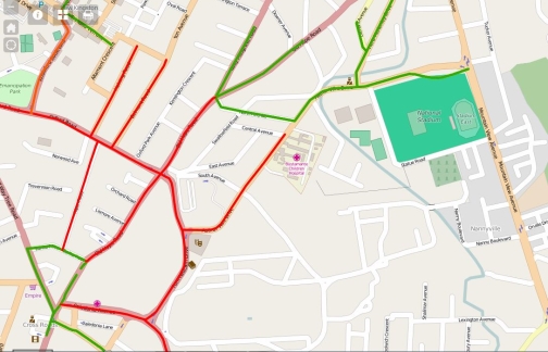
KINGSTON, Jamaica – GeoTech Vision on Wednesday provided OBSERVER ONLINE with a detailed map showing traffic changes in the Corporate Area that are to take effect ahead of the visit of United States President Barack Obama and several Caricom leaders and their delegation from April 8-9.Click here to view the map.
Please note:
· Red lines represent blocked roads;
· Blue lines represent blocked off spots with diversions and these are numbered;
· And green is a thoroughfare with varying blocked spots and diversions.